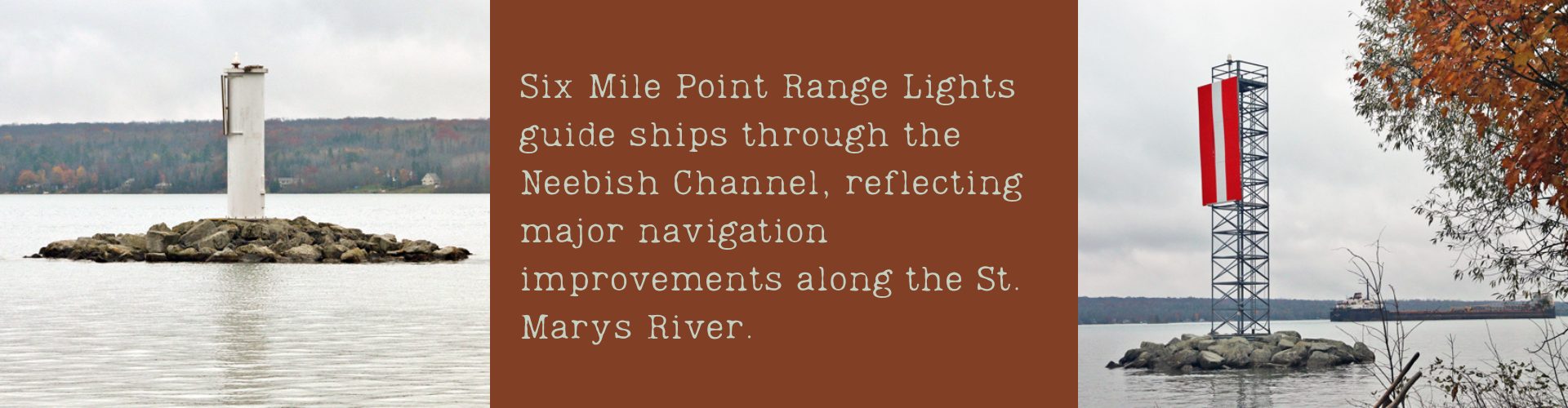
Along the western shore of Lake Nicolet, a quiet pair of navigation lights tells the story of one of the Great Lakes’ most important shipping corridors. These are known as the Six Mile Point Range Lights. They were established to guide vessels through the Neebish Channel. This channel is a critical link in the route between Lake Superior and the lower Great Lakes.
A River of Growing Importance
When the Soo Locks were completed in 1855, they transformed navigation on the St. Marys River. Ships could now bypass the powerful rapids near Lake Superior’s outlet. As a result, this opened the way for increased movement of ore, timber, and other cargo.
East of the locks, the river flows toward Sugar Island before dividing into two main channels. One branch, once called Hay Lake Channel and now known as Neebish Channel, became increasingly significant as shipping traffic expanded. Recognizing its importance, Congress funded major improvements beginning in the early 1880s. Over the next decade, the channel was widened and deepened to accommodate larger vessels.
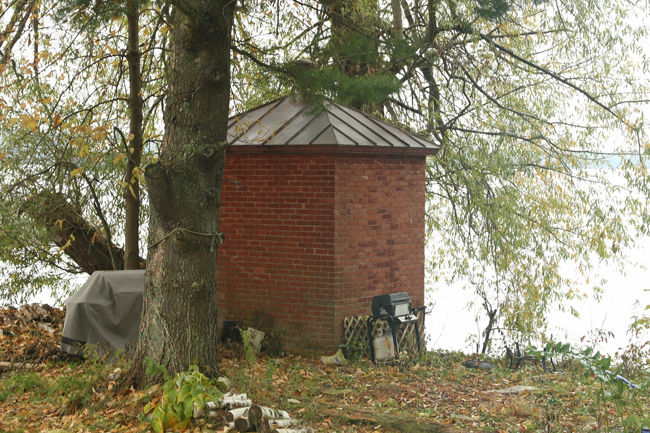
Historic Brick Oil House
Lighting the Channel
With navigation improvements completed by 1894, attention turned to marking the route with reliable aids to navigation. Funding was provided that year for a series of lights numbered along the channel. At Six Mile Point, land was acquired for a rear range light, while the corresponding front light was placed offshore on a crib foundation.
Supporting structures soon followed. An oil house and a landing dock were constructed in 1898, providing essential infrastructure for maintaining the lights. These facilities reflected the logistical challenges of operating navigation aids in remote stretches of the river.
The 1907 Towers
By the early twentieth century, plans were made to replace earlier lights with more durable structures. In 1906, pile foundations were prepared for a new set of range lights marking the axis of the channel at Little Rapids Cut. The following year, white cylindrical steel towers were erected and placed in service.
The front light stood in deeper water, with its focal plane set twenty eight feet above the surface. The rear light, positioned closer to shore, reached a focal height of forty seven and one half feet. Together, the lights formed a precise visual guide, allowing mariners to align their vessels safely within the channel.
Life Around the Lights
Maintaining these navigation aids required practical solutions. At one time, a nearby property owner was contracted to tend the lights, traveling by boat to perform necessary tasks. The lanterns themselves were raised and lowered using a cable and winch system located within the towers.
Electrification arrived in 1933, marking a shift toward more modern operation. Over time, the original steel towers were replaced by newer structures. Today, the front light is displayed from a cylindrical tower, while the rear light is shown from a skeletal framework.
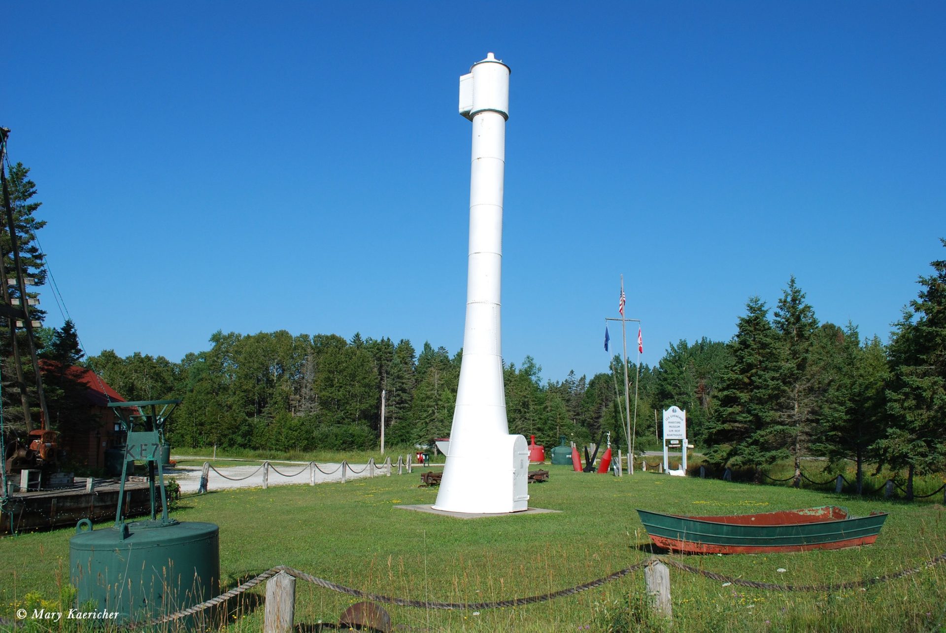
Rear Tower at the Les Cheneaux Historical Museum
Preservation and Legacy
Though the original towers are no longer in place along the range, they have been preserved as part of the region’s maritime heritage. The former front tower now stands at the DeTour Passage Historical Museum, while the rear tower is displayed at the Les Cheneaux Historical Museum.
Near the modern lights, the historic brick oil house still remains, offering a tangible link to the era when keepers carefully maintained these beacons along the river.
Guiding Passage Through the St. Marys
The Six Mile Point Range Lights continue to serve vessels navigating the Neebish Channel, one of the busiest inland waterways in North America. Their presence reflects both the engineering achievements that reshaped the St. Marys River and the enduring importance of safe passage between the Great Lakes.
In this quiet stretch of shoreline, the steady alignment of two lights still marks the path first illuminated more than a century ago.
Explore our full collection of Northern Michigan lighthouse stories here
Start planning your trip today and explore the legacy of Michigan’s maritime history!
📍 Explore the Map Below